
E’ passato parecchio tempo da quando ho intrapreso un viaggio transcontinentale e la tecnologia e’ definitivamente cambiata. Esistono multiple liste e risorse su cosa portare basandosi su tipo di viaggio si intraprende. Adesso anche apps nelle quali si dice destinazione, stile di viaggio e producono la lista di cosa portare.
In questa pagina voglio illustrare quanto abbiamo portato per il nostro viaggio in Centro America viaggiando con un veicolo e cosa stiamo utilizzando per il nostro viaggio nel Sud Est Asiatico con zaino in spalla, la lista non è molto differente. La lista parla solo di sistemi di comunicazione orientamento e fotografia.
Long time has passed from our last transcontinental trip. The technology has changed a lot. Online you can find multiple list that provide what you have to bring on your trip based on where you are going for how long you stay away, what is your style and what are your objectives. In this page I want to show what we have used in the last trip in Central America in a vehicle base travel and what we are using now on our backpacking in South East Asia. The list is just about comunication, mapping and photographing
Hardware:
Backpacking:
iPad Apple (A1567) 16 gb
iPhone 7
iPhone 5
Rawpower RP-wd03
Fish eye lens and telelens for iPhone
Tripod and remote control for iPhone
Chargers and cables.
USB card for backup data
Pelican containers For safekeeping of devices.
Garmin gps
Electric plugs adapters
For a vehicle base trip we added
Nikon Coolpix P900 83x
Bluetooth amplify speaker
Track SPOT
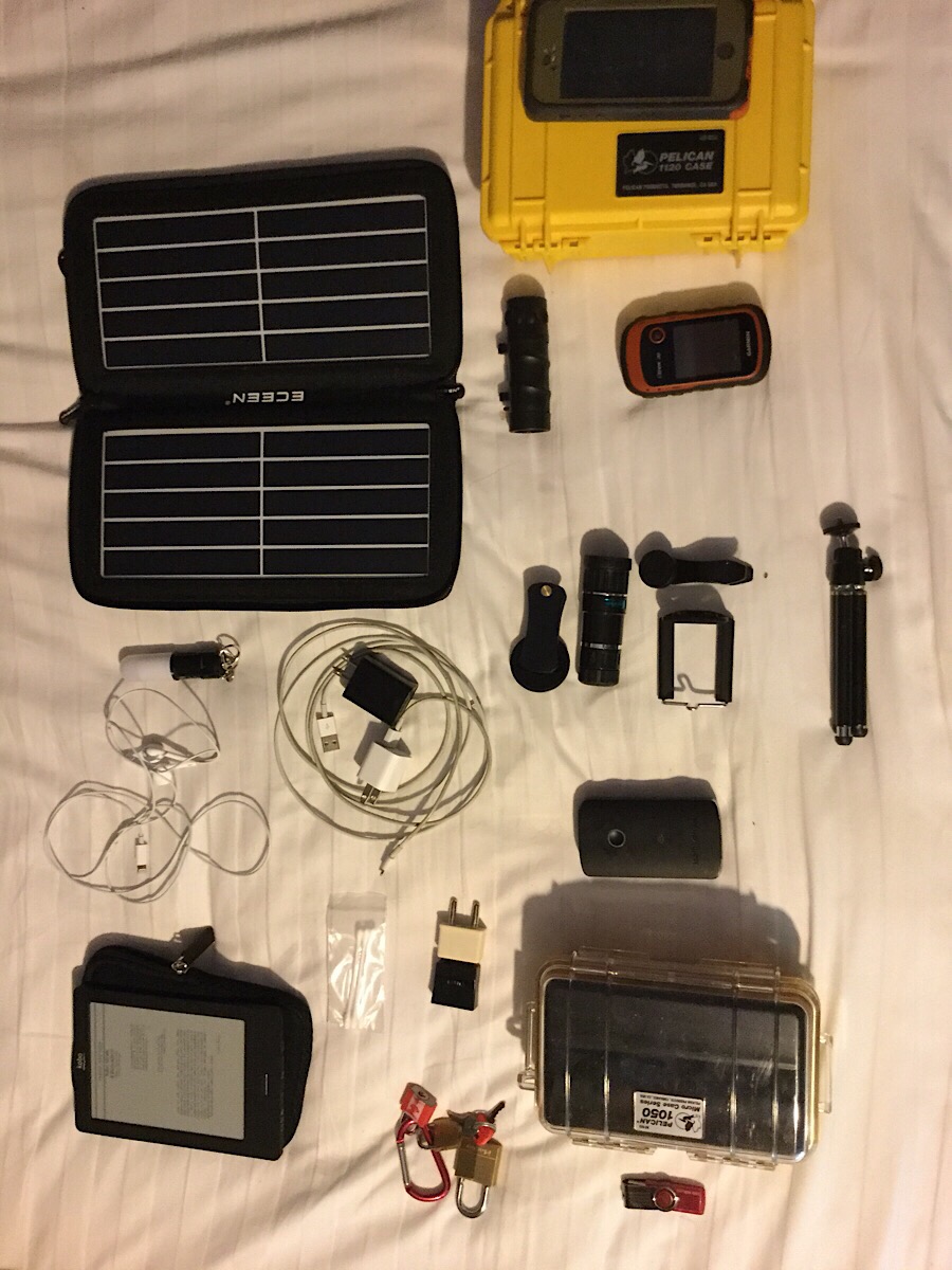
Elettronica da viaggio
iPad :
Good size for checking maps good contrast and brightness. Size and weight make possible to use it during tracking. The iPad is our main instrument to use for checking emails managing data and look at information and entrateinment. It has some disadvantages compared to a laptop but we can do 90% of what we need to do. We use also iPhones so choosing to stay on the Apple platform make it easier, we can use the same apps and use the phone for back up in the case of breakage or our iPad is stolen, 16 GB is sometimes a little bit of a limitation, maybe a mini version will add portability and maybe an external keyboard would make our typing easyer. We add a silicone rubber case it was a little bit of protection
iPhone
The phone in the end is used for everything excep phone calls… If you have it unlocked and you plan to stay in some country for a bit makes sense to buy a local sim normally at border crossing you can find them
Because we were planning to cross lots of countries and stay short time in each we didn’t consider to get a local Sim card, the are other things with our Canadian Telus contract we can activate roaming for $10 a day, this is very useful when you have an emergency you can make your calls or every once in a while if you are in remote area and you don’t have Internet access locations access you can use your phone and use your Canadian data plan. At the end we have never use Romain, that is always a bar at Walmart and McDonald’s that that free access, we leave our phone with data Off, that allow us to use their GPS functions and the additional accuracy of cell tower triangulation. And you can still see if someone is try to call you or message you and as long you do not answer you do not pay.
The phone is great take panoramic shots, and is very quick compared to a regular camera you can just pull it out of your pocket and take a snapshot without being very invasive like with that big camera we have two phones with waterproof cases. I like the otter cases, a bit bulky but sturdy.
During our last trip we update one of the two phones to iPhone 7 more memory better camera and bigger screen make a big difference unfortunately to use additional lenses You have to remove the case, fortunately iPhone 7 waterproof so we are in the you have to remove the case, fortunately iPhone 7 waterproof. Still unhave to be a little more careful.
Rawpower RP-wd03
Without a PC or a computer is a bit difficult to make a cup of all the data that quickly build up. Especially with the iOS devices is hard to handle backup.
Buckley we found this device, it is in route there so you can connect their cat five cable and if you’re on Wi-Fi access, it has a battery so you can recharge in case of emergency your camera, phone, iPad but the most useful feature is that has a slot for SD card and one for USB sticks. With their app you can backup pictures and movies from your phone to ST card or USB and if your camera has a SD card you can move file from the camera SD card to the USB so you can make backup of your camera files, you can also move files from the camera to your iPhone so you can publish or put on the cloud.
Fish eye e tele for iPhone
If you wanted to travel light SRD cameras not an option that forms optics are great but still have limitations. So we decide to buy a set of lens that you can apply in front of your phone. There are different kind of sets the one we got has a 15x telelens , a macro, and a fisheye
Tripod and remote control for iPhone
To make selfies and the long exposure picture and use a Tella lands as small tripod is very important doesn’t take too much room and weight is not the concern in our lens kit we had the tripod and also a remote to control the camera shutter of the iPhone.
A container that keep everything in order and safe is a plus.
Photovoltaic solar charger
If u plan backpack in remote area for extended time it’s possible you don’t have any access to power to recharge your device, and now days we have lots devices. so we brought with us 10 W panel small enough to stay on the backpak when u hikes. 300g weight. And 2h to charge a phone.
Cables and Chargers
They don’t take too much space or weight so we bring up 2 for each different type of connection, it’s hard to find them somewhere if they brake o4 u loose them.
USB card per backup dati
With our backup system we can transfer data on SD cards or a USB, USB sticks are cheap so we brought some extra to make back up, they are also the easyest way to transfer data if you’re going to Internet shop to Print something or you want to give some data to someone.
Pelican containers
Especially when you back but you want to have your electtonics in a safe container water and impact proof , we choose to take two and split our electronics in the two backpacks so if one get lost or stolen we have the other one with our back up device.there are other makers and there are different models. Some of the old ones are a little more heavy. There is always a balance between weight and strength.
Garmin gps
Maybe just because I have one I toss in my backpack a Garman GPS hand held it has a better accuracy then the phones because it use Both gps signal and the GLONASS satellite constellation (Russian gps) it has also tracking feature and Maps
In Our vehicle base trip we add
Nikon Coolpix P900
After years of DSLRs cameras (Digital Single Lens Reflex ) And bringing 45 lenses each time we decide to move to something like that the main thing I want a Camera of this type used to have a powerful Telelens to capture animals in there Habitat. At the end of the day if you want a bright lens that is at least 600 mm you end up spending a lot of money and taking a lot of space .
So I sold one of my lands and with the price of one use lens I bought a Nikon Coolpix P 900
di reflex e portarsi in giro diverse ottiche ho optato per una “point and shoot”. Durante i nostri viaggi ci piace catturare foto di animali. Per questo la cosa più importante e avere Quindi dopo varie ricerche sono finito a prendere la Nikon Coolpix p900 che ha uno zoom 83x (zoom ottico equivalente ad un 24-2000 ! su 135) . Non ha un sensore full frame ne la possibilità di salvare in formato RAW , ma per il resto è economica, leggera, compatta e se si ha la necessità di stampare in un formato a4 o a3 non ci sono problemi di qualità . Le foto sono georeferenziate che è sempre interessante e con apposita app si può anche scattare foto remotamente controllando zoom e esposizione dal dispositivo iOS .
Cassa Bluetooth per Fruizione materiale AV
Per giorni piovosi una buona idea è portarsi qualche film su una cartuccia usb e tramite il Rawpower si possono vedere su iPad una cassa amplificata migliora la fruizione, podcast e musica sono anche più facili da sentire con casse amplificate. In funzione del budget si possono avere da casse economiche a 10 euro a casse amplificate dieci volte più costose.
Track SPOT
Purtroppo tutto il mondo è paese e tornare al parcheggio e non trovare più il proprio veicolo o essere fermati e derubati del proprio mezzo capita. Per questo motivo ho installato un sistema di tracking satellitare. Il prodotto lavora con localizzazione GPS e invio delle coordinate a intervalli configurabili (massimo ogni 15 minuti) . Costo circa 150CND$ per l’ardware e 150CND$ per un contratto annuale. Il vantaggio rispetto ad altri sistemi e che non si appoggia a reti telefoniche quindi funziona in tutto il mondo. Si può anche attivare una funzionalità che manda notifica ( email) quando il dispositivo si sposta. Cosa utile ad esempio nel caso della macchina lasciata in un parcheggio mentre si va a fare un trekking di 3 giorni. Data la dimensione compatta e possibile nasconderlo in pochi poco visibili e difficili da sospettare. È impermeabile e molto resistente, unica nota dolente alimentazione e con USB o comunque a 5v per cui bisogna comperare un apposito cavo (che garantisci e anche la impermeabilità) per poterlo alimentare a 12V
https://www.findmespot.eu/it/index.php?cid=128
Montaggio dei dispositivi
Purtroppo per mancanza di tempo le mie ricerche su durevoli dispositivi per assicurare i vari sistemi di navigazione non sono andati a buon fine. Sono finito per prendere un dispositivo con accoppiamento magnetico che si inserisce nel porta CD . Ottima idea e funziona decentemente con telefono su asfalto su sterrati e con tablet non si supporta molto. Precedenti sistemi a ventosa sul parabrezza forse per la qualità non alta non mi hanno mai soddisfatto. Quello che funziona decentemente è invece un sistema sempre con accoppiamento magnetico che si inserisce nel porta bicchiere. Un sistema ad espansione garantisce la stabilità,un plus è che vengono messi a disposizione due porte usb per caricare i vari dispositivi. Gadget comperato su Amazon..
Software
Tutto e sempre in evoluzione e quello che era la cosa migliore ieri non è più valido o e uscito qualcosa di nuovo, le applicazioni che indico sono in giro da un po’ e sembra essere ancora valide e aggiornate..quindi:
Mappe e navigazione
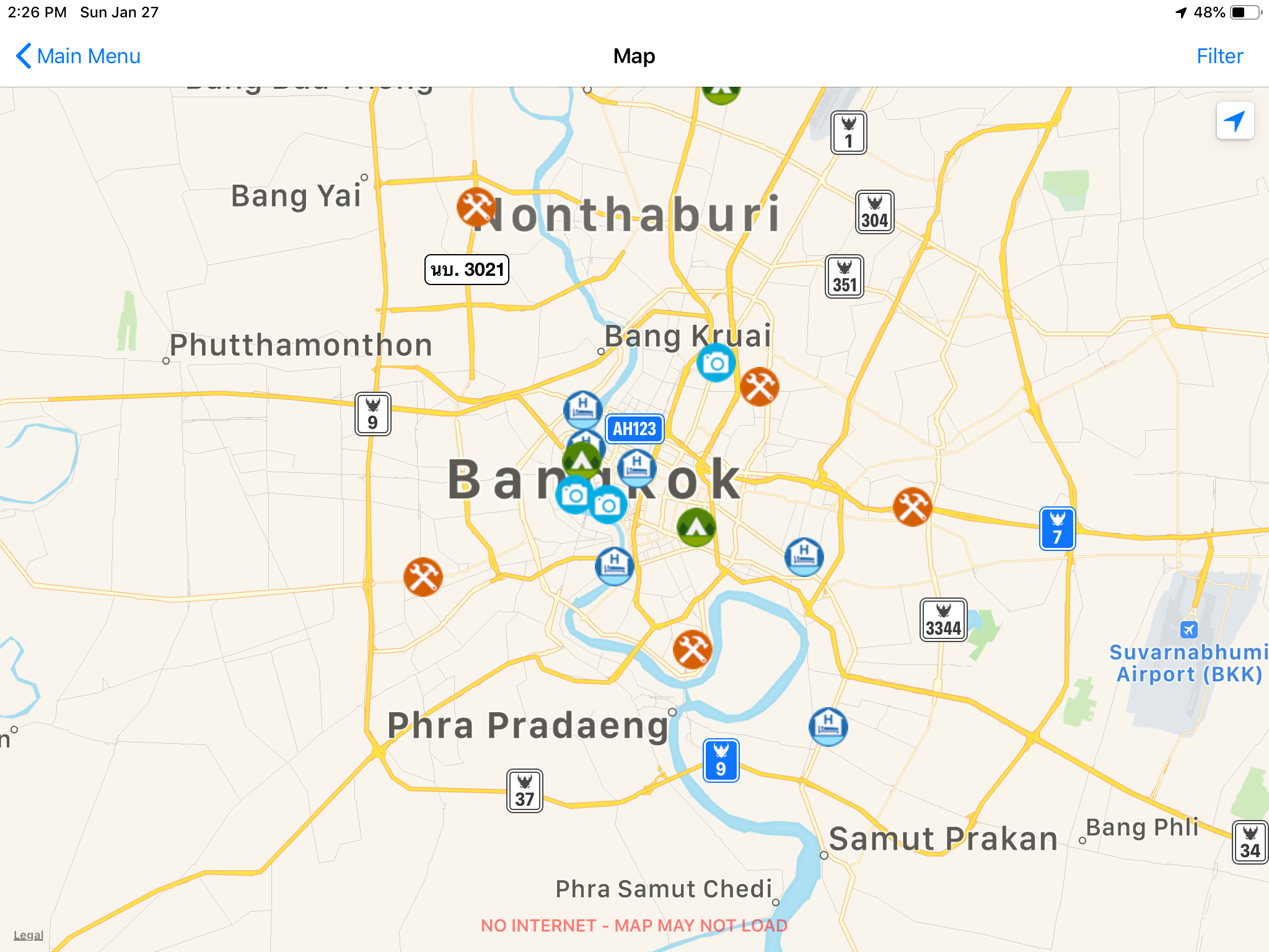
È sempre bene avere più di un sistema di navigazione dato che a volte un sistema è migliore di un altro su sentieri, altri sono migliori per trovare attività altri hanno informazioni su trasporti locali. Ecco cosa usiamo:
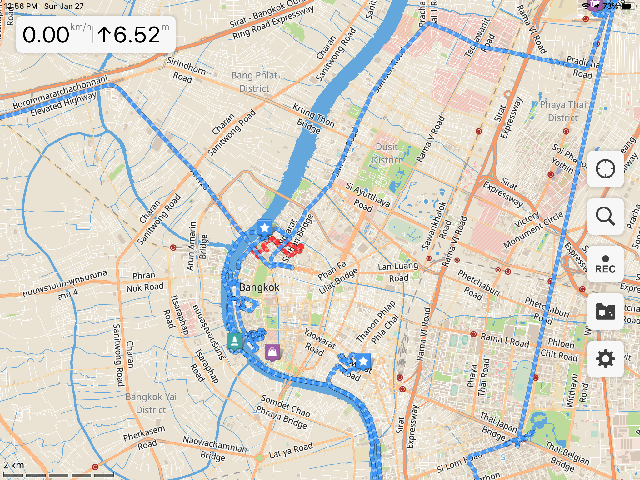
Galileo
Galileo nella versione Pro: ha mappe molto dettagliate, la possibilità di creare tracce e aggiungere punti. Lavora senza connessione. Ha spesso sentieri e tracce non trovati su google maps e anche posizioni di negozi ristoranti e posti dove dormire.
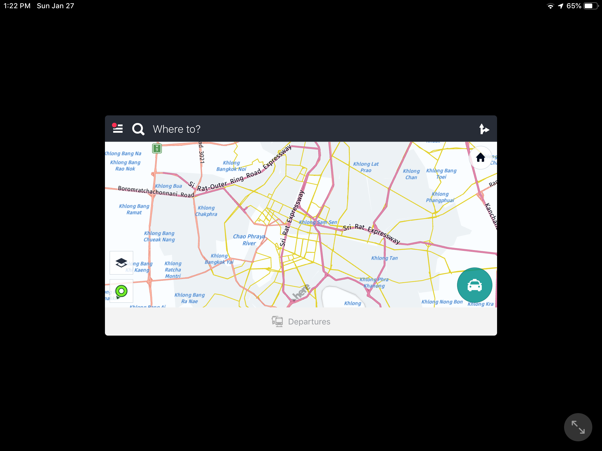
Here
Here : fa routing anche offline , molto primitivo ma veloce e occupazione minima delle mappe, grafica piuttosto semplice, comodo con funzione di allarme se si supera il limite di veloci consentita . Ottimo su vecchi telefoni con schermo piccolo.anche funzione di mezzi pubblici, car sharing , a piedi o in bici.
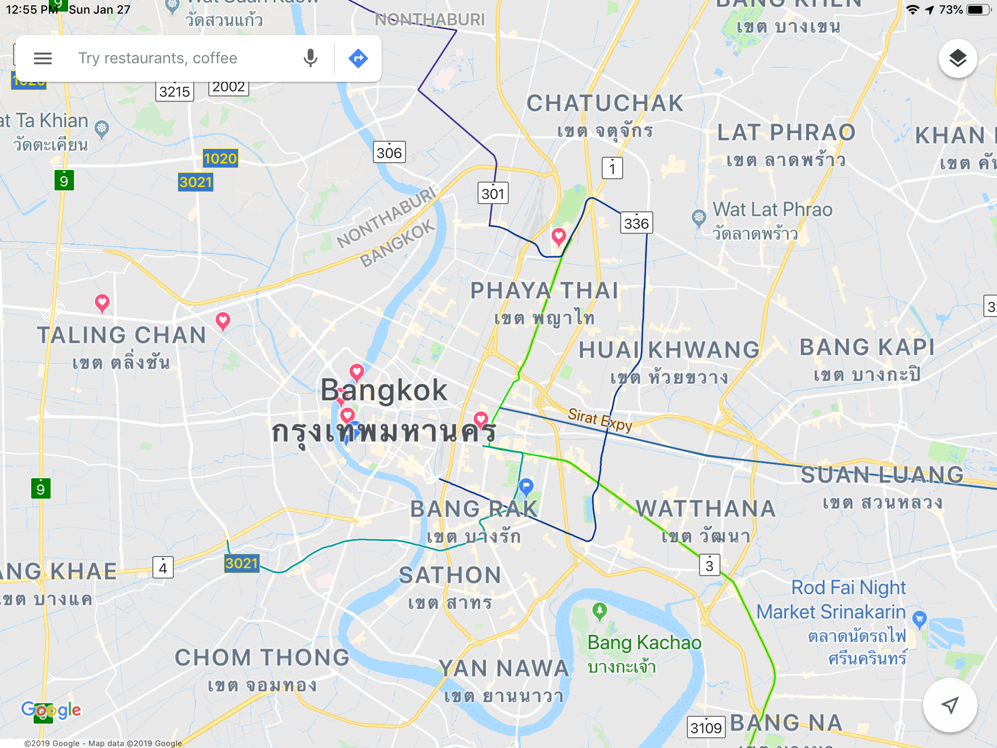
Google maps
Google map: scaricando mappe per fruizione offline è molto funzionale con destinazioni multiple e interfaccia grafica molto ergonomica, su piccolo schermo può essere un po’ sovraccarico. Se si viaggia molto e si vogliono molte mappe può essere necessario molto spazio. L’unico app che ha routing anche con mezzi pubblici (non sempre aggiornato con orari ma almeno ci sono le fermate)
IOverlander
iOverlander: penso sia diventato uno standard per viaggiare economicamente trovando posti dove campeggiare gratuitamente, fare doccia o ricaricare le bombole di propano per solo fare un esempio. Strumento molto valido per attraversare frontiere e trovare le informazioni su come fare permessi, importazione temporanea, assicurazione e visti. Il sistema visualizza le mappe solo se collegati a internet o preventivamente è stata caricata l’area quindi può essere difficile da usufruire, i punti però vengono visualizzati senza la mappa di sottofondo quindi ancora utile quando state disperatamente cercando un posto dove accamparvi. Altre note utili sono zone pericolose sia per natura topografica (strade franate etc) sia di natura umana (posti di blocco, polizia corrotta, furti etc)
Mapsme
MapsMe: Non lo usiamo estensivamente ma sembra essere molto valido per trovare negozi, hotels etc. Anche funzione di routing con mezzi pubblici a piedi o bici, possibilità di inserire foto e creare web report (maiprovarlo…).
Altre app:
iTranslate : applicazione piuttosto cara dato che richiede sottoscrizione ma molto interessante per poter comunicare e capire segnaletica e altre scritte in alfabeti differenti dal nostro (Vietnamese, cinese cirillico,tai, giapponese etc) . Purtroppo non tutte le lingue sono disponibili off line (Burmese ad esempio che ci farebbe comodo) funzione di OCR con traduzione istantanea incredibile. Anche riconoscimento vocale e traduzione istantanea, provare per credere.
EMR emergency Medical Response , applicazione utile in caso di incidenti utile per rinfrescare la memoria su come procedere per fornire pronto soccorso. Consiglio sempre di fare un corso di pronto soccorso, non so in Italia come funzioni, in Canada ci sono corsi di RFR remote first responder che insegnano le basi per intervenire in caso di incidenti in aree in cui non si riescono a ricevere aiuti esterni entro 45 minuti. Esistono una miriade di applicazioni, croce rossa etc etc, spesso gratuite, provatele per familiarizzavi prima di averne bisogno…
VoiceTra ottima applicazione free per traduzioni real time con riconoscitore vocale, purtroppo richiede connessione internet, però una volta che si è tradotto qualcosa si può andare nella history e rivederla e risentirla, uno si può quindi creare un elenco di frase utili e riascoltarle o farle ascoltare. Ottimo per noi ad esempio in Myanmar dato che iTranslate non funziona offline con il Burmese e spesso non si ha copertura telefonica.
Just write: una applicazione leggera e semplice per scrive note e appunti.
File hub plus: applicazione specifica per gestire il router e backup esterno
SPOT app: sistema per controllo del dispositivo di tracking
se avete poi specifiche esigenze e obbiettivi avrete le vostre app. Per gli amanti delle pedalate Fork, sempre divertente guardare le stelle con StarChart, per sentieri e camminate in Canada l’ominima Canada ha scaricabili tracce e sentieri su overlay di mappe rast (occupano molto spazio) .